 | mobile - desktop |
 |
 |
| mobile - desktop |
|
|
News & Events:
|
| [ Login ] [ User Prefs ] [ Search Forums ] [ Back to Main Page ] [ Back to Kingsnake Forum ] |
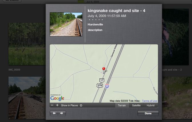
Posted by: rtdunham at Tue Sep 15 22:53:00 2009 [ Email Message ] [ Show All Posts by rtdunham ] here's what you see when you click on the little "places" icon on a geotagged photo in Apple's iPhoto. The locations can be off by 10 or 20 yards sometimes, but this one seems accurate almost to the foot. You can zoom in or out, and see the location in satellite or hybrid view instead of this street view. Satellite shows forest density, bodies of water, etc.; the hybrid view overlays that with the roads seen in this image, and is my favorite view. That's a thumbnail of the photo in question, btw. | ||
>> Next Message: RE: a few examples - DMong, Tue Sep 15 23:09:08 2009 >> Next Message: and here's the satellite view - rtdunham, Tue Sep 15 23:10:30 2009 >> Next Message: RE: a few examples - thomas davis, Wed Sep 16 11:46:07 2009 | ||
<< Previous Message: A pitch for geotagging photos - rtdunham, Tue Sep 15 21:43:13 2009 | ||

|
|

|
|